 NimbleMap
Free · Mac & Windows · offline
GeoTIFF viewer
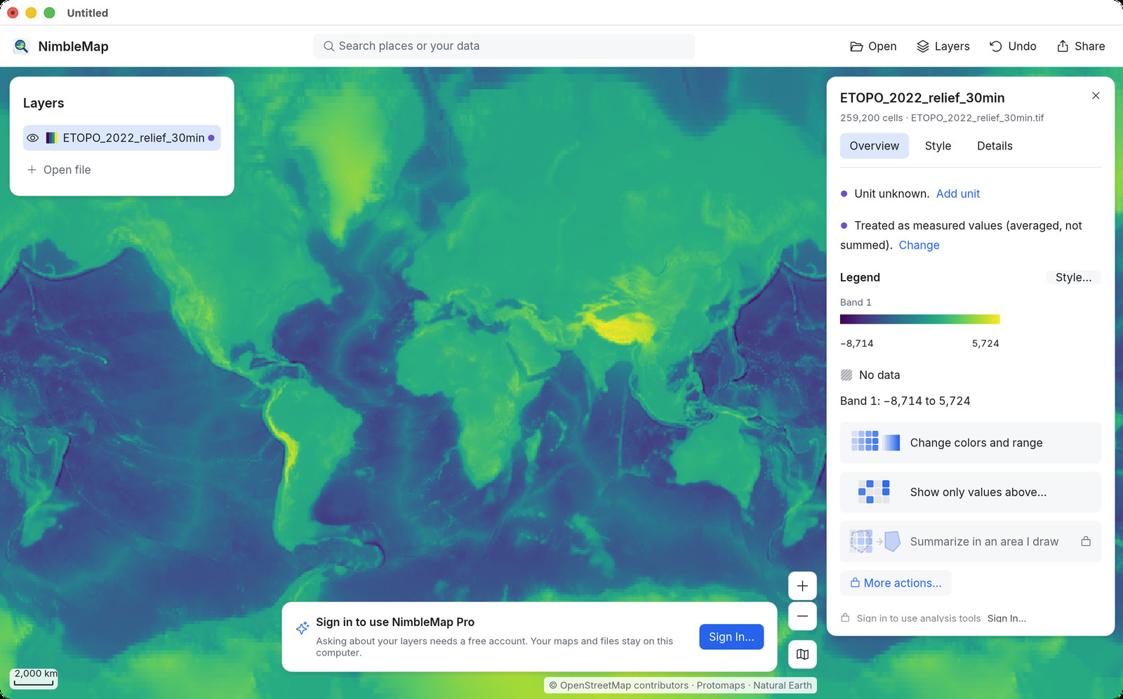
Open a GeoTIFF (.tif / .tiff) as a map in one drop. Free for Mac and Windows. Drag and drop; files stay local. Preview ignores georeferencing — this doesn't.
How · .tif / .tiff
Drag it open on Mac or Windows
Drag the .tif into NimbleMap (or right-click › Open With). It sits under or over your other layers. Click a cell to read its value; colour by value with a legend.
Why not a browser tab or QGIS
Free, local, and enough for a look
Preview and Photos open a GeoTIFF as an ordinary image and ignore where it belongs on Earth. Browser GeoTIFF viewers are fine for a peek; large local files and stacking with a Shapefile or CSV work better on the desktop. You do not need QGIS just to see where the image sits.
Questions
Common questions
Why does Preview open my GeoTIFF but not on a map?
Preview ignores the location stored inside the file. NimbleMap reads it and draws the image in place.
Is there a GeoTIFF viewer for Mac without a full GIS?
Yes. Drag it into NimbleMap on Mac or Windows — no CRS ceremony.
Can I open a GeoTIFF online and offline?
Try the browser demo for a quick peek; download the desktop app when files should stay local and work offline.
Can I open a GeoTIFF without QGIS?
Yes. Drag the .tif/.tiff into NimbleMap; no project or CRS setup first.
Does NimbleMap upload my GeoTIFF?
No. Desktop and browser try keep the file on your device.
Is there a free GeoTIFF viewer for Mac?
Yes. NimbleMap is free on Apple silicon Mac and on Windows, plus a browser try.
Can I view large GeoTIFF rasters?
Yes for typical download sizes. Extremely large rasters may be slower; try a smaller overview if the UI stalls.
Do I need an account to view GeoTIFF?
No. Accounts are only for optional Pro Ask.
Can I overlay GeoTIFF with vector layers?
Yes. Open Shapefile, GeoJSON, or CSV alongside the raster.
Offline GeoTIFF viewing?
Yes. The file stays local; only basemap tiles need network if you use them.
Also see: Shapefile viewer · GeoTIFF viewer · GeoJSON viewer · GeoPackage viewer · NetCDF viewer · CSV to map · vs QGIS